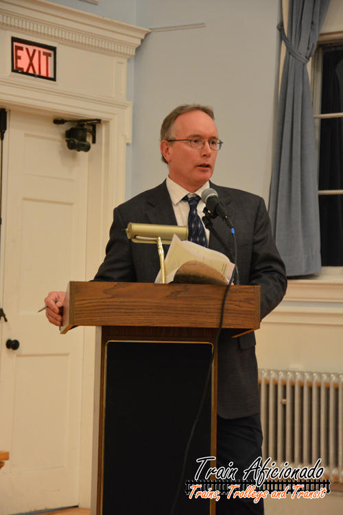
Robert Weidknecht of Beals + Thomas
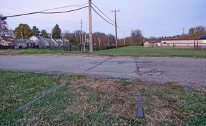
You wouldn’t know it today, but both Millis and Dover, Massachusetts were once busy railroad communities. The Millis Branch cuts right through the centers of Dover and Millis, and the tracks are still in place throughout the whole right-of-way, which looks abandoned from west of Needham Junction to Medfield Junction; a total of nearly 8 miles. It’s been nearly 50 years since these rails saw passenger service south of Needham. As for freight service, I’m not sure when the last freight trains traveled down the branch. The railroad tracks are still visible where they cross streets and signage is still posted that at most locations as well. Today, most of the right-of-way is overgrown with high grass and brush.
Special Meeting
A special town hall meeting was held on Thursday, January 14, 2016 looking for input from the public concerning a proposed “Rails-to-Trails” recreational path along this MBTA owned right-of-way. In 2011, Dover Rail Trail Committee (DRTC) was the first group to do a study on doing a Rails-to-Trails project in Dover.
The meeting started few minutes after 7pm in a packed room of Dover residences. Robert Weidknecht from Beals + Thomas, a Southborough MA consulting firm, gave a 30 minute presentation about his Feasibility Study – Dover Recreational Path. Weidknecht gave a detailed overview of the 86 page study. – See full study

The Right-Of-Way
This rails-to-trails project has a lot of similarities when comparing it to the recently completed project in Holliston, MA. The trail would run on the current roadbed of the Millis Branch, running 3.5 miles from the Medfield Town line to the Center Street overpass. There aren’t any plans to cross the Charles River Railroad Bridge. This trail would be independent and would not connect to the Needham trail. Like the Holliston Project, the right-of-way would be a 10’ stone dust path, and some areas of the path would be narrower due to terrain

Construction
In order to move forward with the project, the rails and railroad ties would need to be removed from the right-of-way. This would be something done along with the MBTA since the town would be leasing the property from them. Once removed, the roadbed would be capped with a minimum of 6 inches of a compacted gravel base, and 2 feet of compacted stone dust would be placed on top of that. The right-of-way crosses five major roads through Dover. Safety devices, signage, and pedestrian visibility will be factored in to make each of the 5 major intersections safe for trail users and road traffic. The study estimates a total of 155 parking spots will be available in different locations along the trail on the weekends. Along the trail there will be guard railing put up for elevated locations and screens (plants/fencing) for abutters’ privacy.

Cost of the Project
In the report, you can see three different options: the basic estimated cost is $941,000, the high is $1,374,000. and the recommended plan would be $1,075,000. – see report
Public Concerns
After Robert Weidknecht’s 30 minute presentation, residents of Dover could ask questions regarding the study. Typical questions were brought up about having a proposed rail trail, and ranged from crossing safety, trash removal, more parking options, property values, environmental concerns, crime/policing, paying for the project, and grants.
My Impressions
As I have mentioned in past blog entries about Rail-to-Trails, I’m a huge advocate for these projects if the right-of-way is inactive/abandoned. After looking at the report and looking at the right of way from Google Earth, I think it will be a nice 3.5 mile route offering scenic views. Most of the people that attended the meeting were positive about the project. There was a handful of property abutters not happy about a trail behind their backyards, but the way I see it, when purchasing a home it’s no secret the right-of-way is there. In this case the tracks are still visible, and three things could happen:
1. The right-of-way just gets overgrown and it is left alone.
2. The railroad that own the property decides to re-activate the rail line.
3. The right-of-way turns into a Rail-to-Trails recreational path.
I plan on keep an eye on this project to see if it gets any traction.
Links